
Bird Island Texel
- Location and arrival
- The bird island
- Wagejot
- De Petten
- De Geul and Horsmeertjes
- De Slufter
- The equipment
- Conclusion
- Download maps Texel
Location and arrival
The Dutch island of Texel belongs to the province of North Holland and is at the same time the largest of all West Frisian Islands in the North Sea. In a north-south direction, the island has a length of just under 24 km and in width, the island measures up to a maximum of 9.6 km.

The ferry from Den Helder to the island of Texel operates hourly. As the exact departure times vary depending on the season, it is best to check the current schedule directly on the Teso ferry service website. As the distance between Den Helder and Texel is only about 4 km, the crossing takes only about 20 minutes.
(back to the top)
The bird island
The island of Texel is a classic holiday destination, and its approximately 13,000 residents have adapted well to tourism. There are plenty of accommodations available at all price
levels. However, it is recommended to book in advance during the high season. For nature photographers, the island offers a variety of birds, and Texel is particularly popular among
bird enthusiasts in the spring. The flight distances of the birds are generally shorter than usual.
The west coast facing the North Sea is characterized by a long sandy beach that stretches from north to south. The sandy beach is bordered by partially wooded dunes of varying sizes.
The east coast is largely built up with a dike, and behind the dike facing the Wadden Sea, there is a smaller sandy or pebble beach.
On the island of Texel, there are several nature reserves that I would like to introduce in more detail below. I do not claim to provide a comprehensive list, but rather focus on the
areas that I have become more familiar with.
(back to the top)
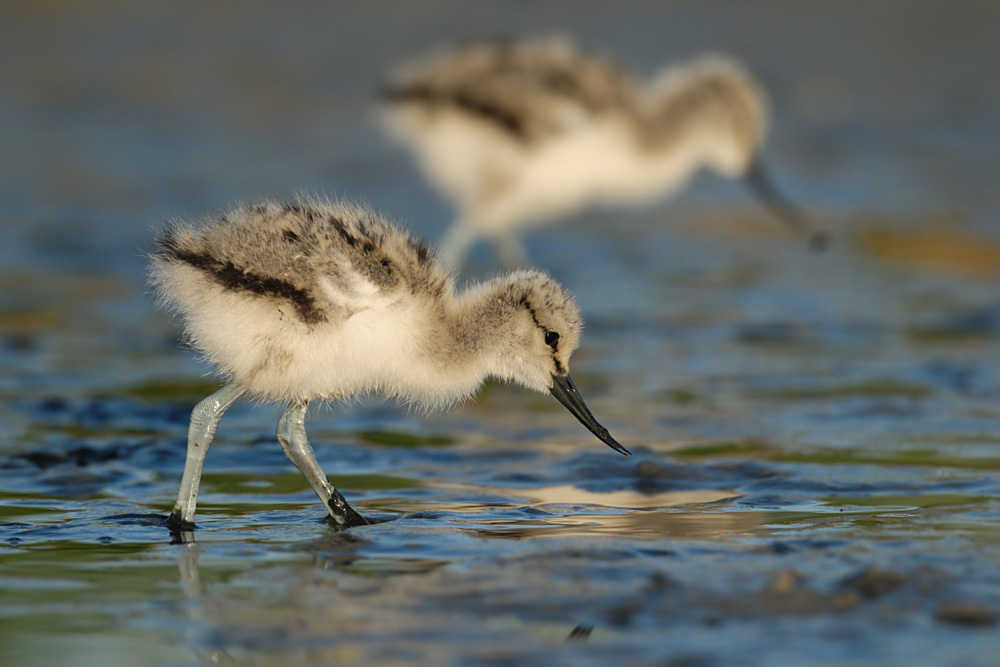
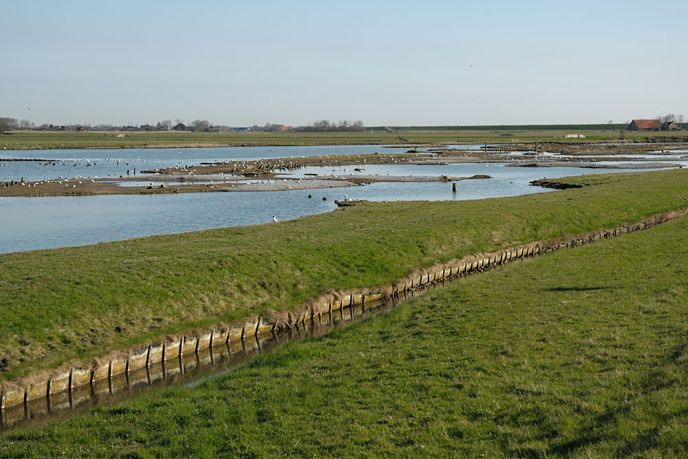
Wagejot


If you follow Wagejot further south towards Oudeschild, you will come to another brackish water lake, which is also located at the edge of the dike. Here, you will mainly find terns and gulls, but you cannot get as close to the action as a water trench prevents direct access.
(back to the top)
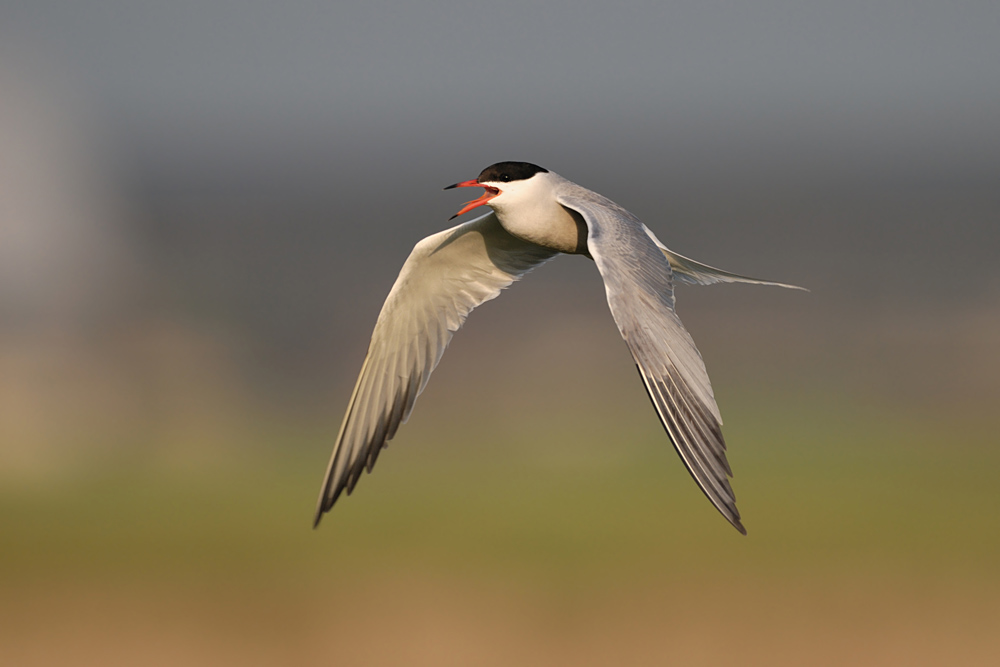
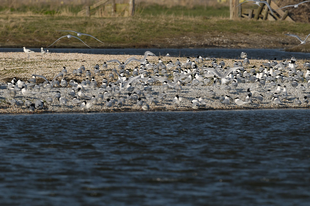
De Petten
De Petten is located north of the "Mokbaai" bay
(see map). The photographic opportunities
at this location are very limited, as the area is completely
fenced and therefore the photographic distances are too great.
The distances only suffice for overview shots of the
common terns that gather there by the hundreds.
Additionally, on clear weather, one can witness a beautiful sunrise at De Petten.
(back to the top)
De Geul and Horsmeertjes


(back to the top)
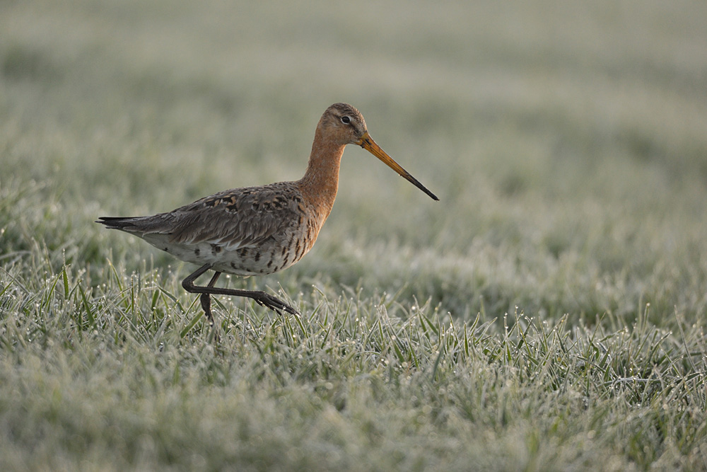
De Slufter

North of De Slufter is the dune area "Eierlandsche Duinen", which stretches from De Slufter to the lighthouse in the north. Here you have good opportunities for photographs of pheasants, harriers, and some songbirds such as black redstart, common redstart, pied wagtail, or meadow pipit. The area "Eierlandsche Duinen" can also only be explored on foot or by bike.
(back to the top)
The equipment
As is often the case with bird photography, a lot of focal length is needed on Texel. Focal lengths of 500-600mm, which can be extended with converters if necessary, are very helpful.
Only at Wagejot, one can sometimes get by with slightly less focal length (400mm). A beach trolley for transporting equipment can also be useful. For those who want to do landscape
photography, smaller focal lengths should of course also be included. Many people prefer a seat (especially at Wagejot), but I personally prefer a sleeping mat, as I prefer the
perspective of lying down.
(back to the top)
Conclusion
Texel is definitely worth a visit. The bird diversity is already very high and the flight distances are also shorter than what is known in many parts of Germany. Especially the entire spring is very suitable for photography. While in April you can witness courtship behavior and territory occupation, in June there is already a lot of offspring to photograph. The island offers many facets and it will probably take many visits for me to get to know the whole island well enough.
Download maps of Texel
You can download maps of Texel here. To view and print them, you will need an Acrobat Reader. The maps are intended for rough orientation only. I also recommend purchasing a larger map, which can be obtained at many locations on the island.

written: May 2010, (author: Olaf Juergens)
